Surveying and leveling
Surveying
• It is the art of determination of horizontal distances, differences in elevation, directions, angles, locations, areas and volumes on or near the surface of the earth.
• It involves the measurement and recording of the size and shape (including the vertical shape) of an area on the earths surface.
The process of survey divided into two parts:
(a) Field work- taking measurements
(b) Office work- computing and drawing
Primary division of surveying
(a) Geodetic surveying
• Also called trigonometrical surveying
• To determine the precise positions on the surface of the earth of a system of widely distant points and the dimensions of areas
• In this survey, the curvature of the earth is taken into account, since large distances and areas are covered.
• Artificial earth satellites have come into wide use in this survey.
(b) Plane surveying
• The earths surface is considered as a plane
• Curvature of the earth is not taken into account, as the surveys extend only to small areas.
• The line joining any two points as a straight line, and all angles are plane angles.
• Surveys normally carried out for the location and construction of roads, canals and, buildings.
• In general, the surveys necessary for the works of man are plane surveys.
Levelling
• Art of determining the relative heights or elevations of points or objects on the surface of the earth.
• It deals with measurements in vertical plane.
• Construction of irrigation and drainage channels, terraces, bunds, reservoirs, outlet structures, etc, require the knowledge of surveying.
• For any soil conservation and land levelling work, levelling is the first job to be taken up.

Dumpy Level Instruments
Dumpy Level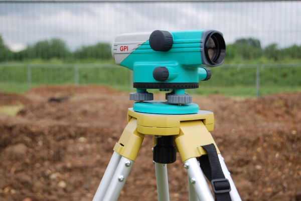
Auto Laser Levels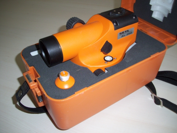
Builders Dumpy Level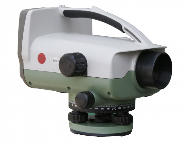
Digital Level
Terminology connected with levelling
Datum:
It is also called datum plane or only datum
A datum surface is usually an imaginary level surface or arbitrarily assumed level surface, from which vertical distances are measured
Its elevation is zero
In India, the datum adopted for the Great Trignometrical survey (GTS) bench mark is the mean sea level at Karachi, now in Pakistan
At present, the mean sea level at Madras is used
Elevation:
It is the vertical distance above or below the datum
It is also known as reduced level (R.L.)
The elevation of a point is plus or minus according as the point is above or below the datum
Bench Mark (B.M.) :
It is a fixed point of reference of known or assumed elevation with respect to which other elevations are calculated
It is a starting point for leveling
Temporary bench marks are selected at the end of a day`s work
There are four kinds of Bench marks
G.T.S (Great Trigonometrical Survey) Bench Mark
Permanent Bench Mark
Arbitrary bench Marks
Temporary Bench Marks
Line of collimation
It is the line joining the intersection of the cross hairs to the optical centre of the object glass and its continuation. It is also called the line of sight.
Axis of telescope
It is a line joining the optical centre of the object glass to the center of the eye piece.
Axis of the level tube or bubble tube
It is an imaginary line tangential to the longitudinal curve of the tube at its middle point. It is also known as bubble line. It is horizontal, when the bubble is centered.
Height of the instrument
It is the reduced level (R.L.) of the plane of sight when the leveling instrument is correctly leveled
It is also called the "height of the plane of the collimation" or the collimation
The line of collimation will revolve in a horizontal plane known as plane of collimation or the plane of sight
Back sight
It is a staff reading taken on a point of known elevation, as on a bench mark or a change point.
Also called a plus sight.
It is the first staff reading taken after the level is set up and levelled
Foresight
It is the last staff reading denoting the shifting of the level
It is the staff reading taken on a point whose elevation is to be determined.
It is also termed as a minus sight.
It is the last staff reading, denoting the shifting of the instrument
Change point
It is the point on which reading is taken just before and after shifting the instrument
That means both back sight and fore sight readings are taken on this point
It is also called a turning point.
It should be taken on a firm, well-defined object